Automated Construction Site Documentation Directly from the Crane
Construction site documentation with TEDAMOS CraneCam enables the automated capture of construction projects directly from the crane. High-resolution imagery, 3D models and orthophotos provide a precise basis for planning, quality control and project documentation.
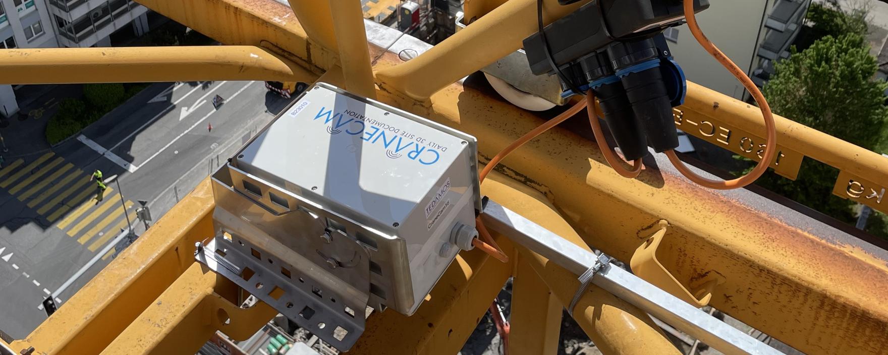
High-resolution cameras mounted on the crane jib continuously capture construction progress. The resulting data is processed into centimetre-accurate georeferenced orthophotos as well as detailed 3D and elevation models, creating a complete digital representation of the construction site.
All data is automatically transmitted, processed and made available through the TEDAMOS Web Portal. Within the platform, users can visualise the data and overlay it with design plans for comparison and quality assurance.
Key Benefits
- Automated construction site documentation reduces site inspections and coordination efforts
- Survey data and digital plan integration provide maximum control over levels and embedded components
- Precise as-planned vs. as-built comparisons enable early detection of deviations and construction errors
- Increased time and cost efficiency through optimised construction logistics
- Complete project documentation for contractual compliance and evidential purposes in accordance with SIA 118
- A clear and reliable basis for site meetings and project communication
The Capabilities of TEDAMOS Web
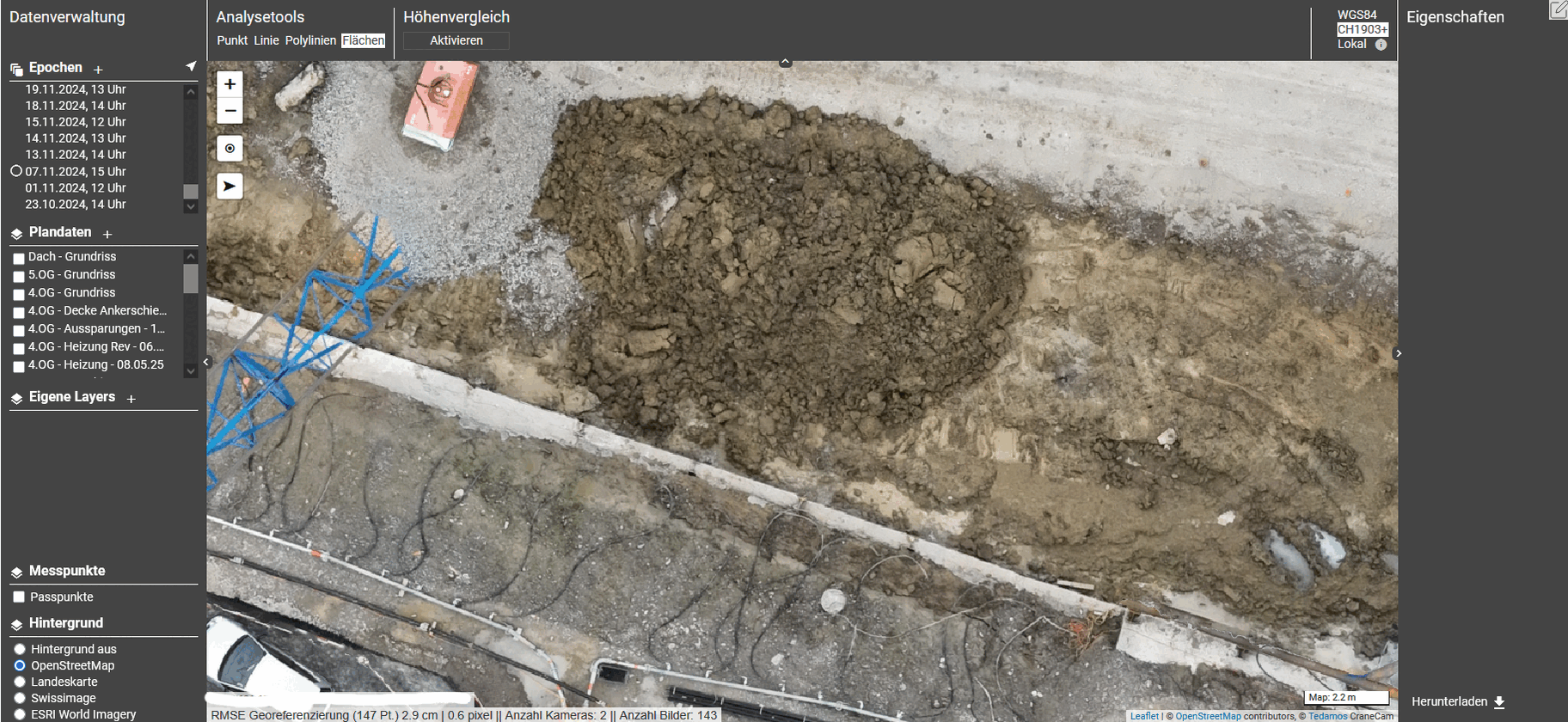
Volume and Earthworks Calculations
Accurate surface and volume calculations provide reliable information on excavation and fill volumes, enabling precise quantity verification and progress control.

Construction Progress Documentation (SIA 118)
Automated documentation provides reliable records for contractual compliance and evidential purposes, while serving as a solid basis for construction management meetings and project coordination.

Construction Logistics Optimisation
By reducing site visits and coordination efforts, CraneCam helps streamline construction logistics and improve overall project efficiency.

Plan Overlays and Installation Verification
Centimetre-accurate as-planned vs. as-built comparisons help identify deviations and construction errors at an early stage.
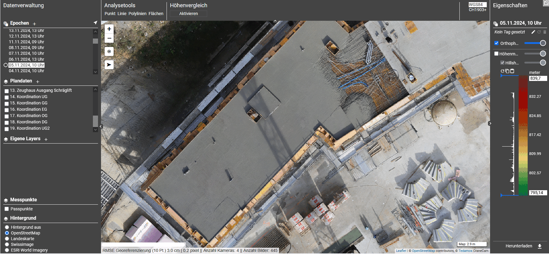
Elevation Models
High-precision elevation models support the verification of slab levels, gradients and surface flatness, helping ensure compliance with design specifications.
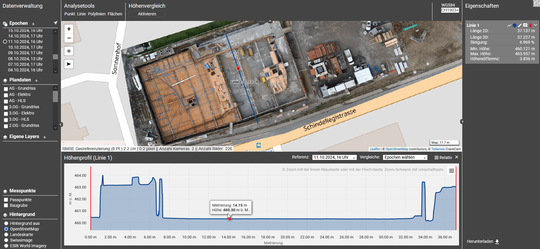
Elevation Profiles
Precise cross-sections and longitudinal profiles derived from the elevation model support the verification of drainage systems, pipe alignments and design elevations.
What Our Clients Say About CraneCam

«The CraneCam is a valuable tool for verifying embedded components and floor plan layouts for everyone involved in the project. Thanks to the integrated design plans, specialist planners can easily review and update installations. With its consistent documentation and excellent image quality, CraneCam has become an indispensable tool for us in construction management.»Simon Weiss, Site Manager Markus Benz GmbH
How Was the Solution Developed?
TEDAMOS CraneCam was developed as part of the Innosuisse-funded BMETRY project between February 2021 and March 2023. The research partner was the University of Applied Sciences and Arts Northwestern Switzerland (FHNW). Implementation was carried out in collaboration with the project partners Terradata AG and avisec ag.
Reference projects Automated Construction Site Documentation Directly from the Crane

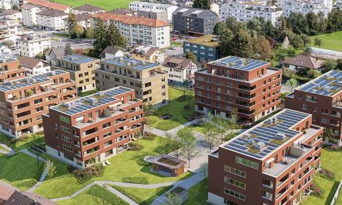
Akara Tower, Baden
Baden, Switzerland
Automatic monitoring measurements and as-built documentation with CraneCam

New building Sammelbüel Teufen
Teufen, Switzerland
Construction pit monitoring and CraneCam documentation
Parco Verde, Schübelbach
Schübelbach, Switzerland
Automatic, image-based as-built site documentation with CraneCam