DroneCam next level
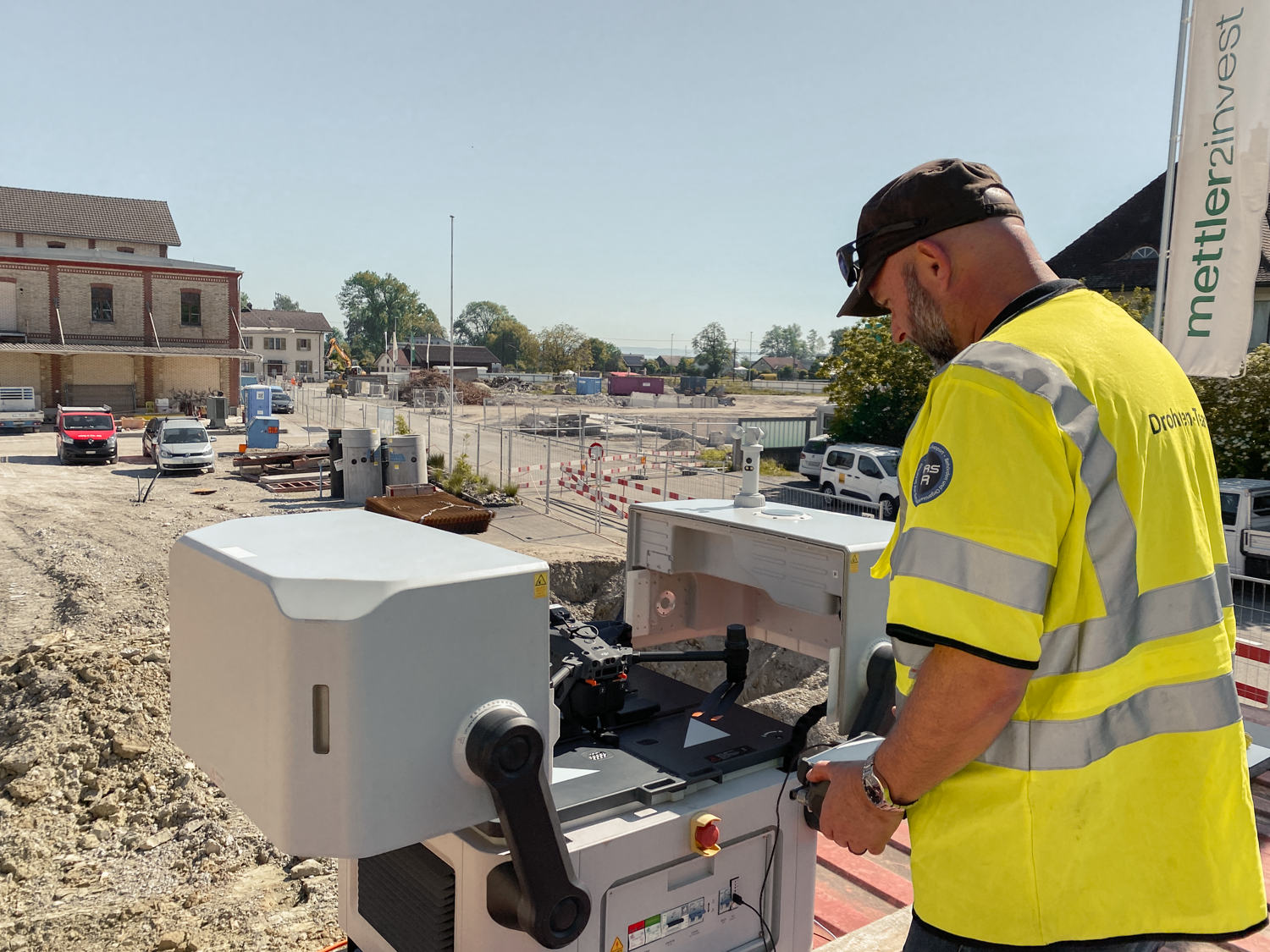
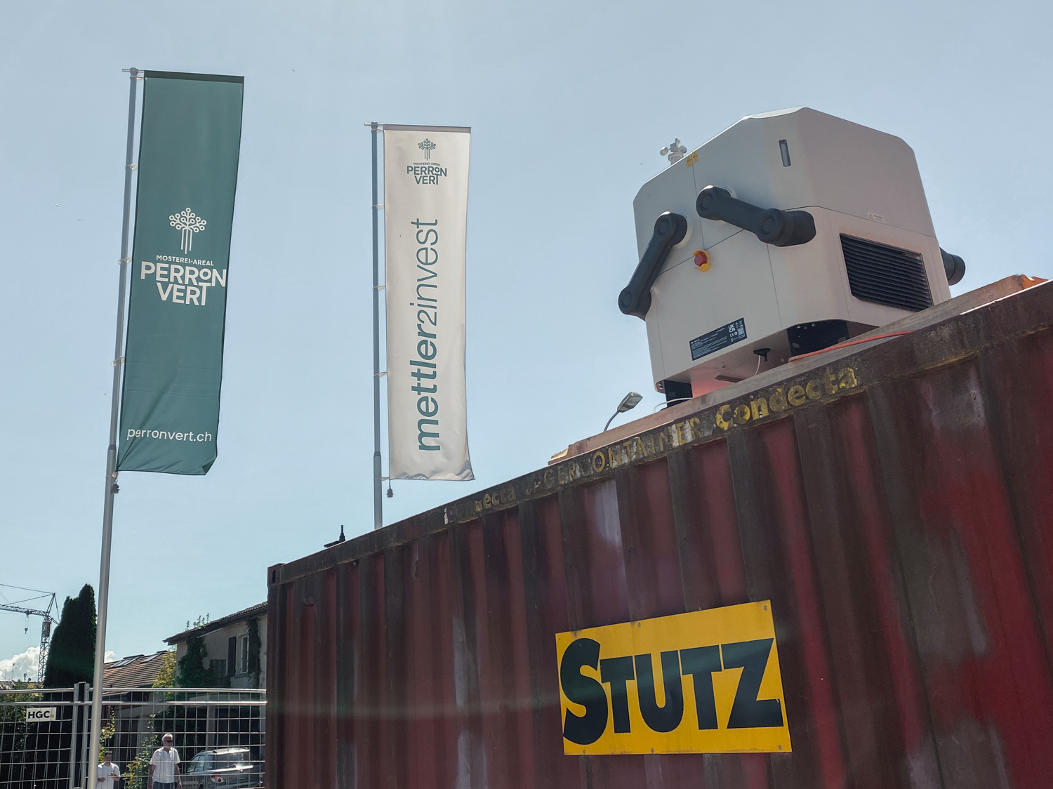
Our drone surveying reaches the next innovative level. This comes in the form of fully automated drone surveying - "DroneCam".
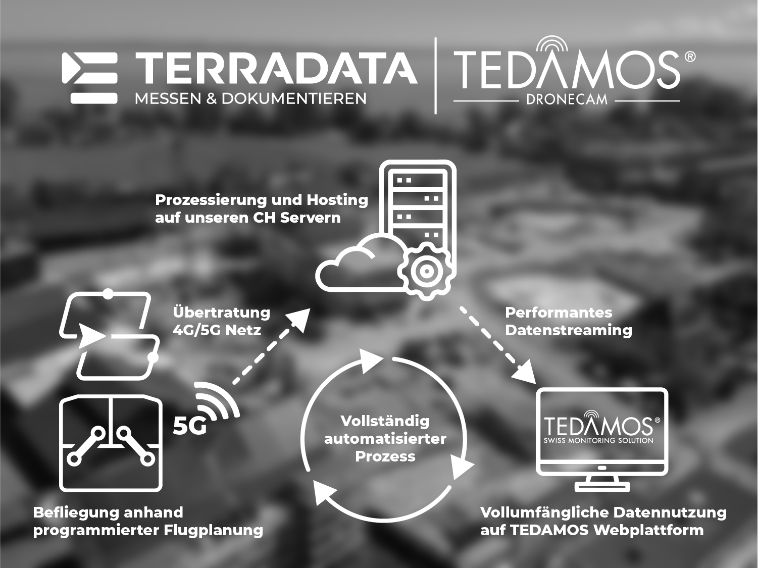
For this purpose, we install a complete solution on site, consisting of a drone and hangar, from which the entire project perimeter is flown at a predefined time interval or on demand. The subsequent data upload, processing on our servers and provision of the data on TEDAMOS Web is fully automated.
This enables seamless construction site documentation of the highest quality, regardless of the size of the construction site and its location. This saves resources and enables the shortest possible response times, as the drone is ready for use at any time.
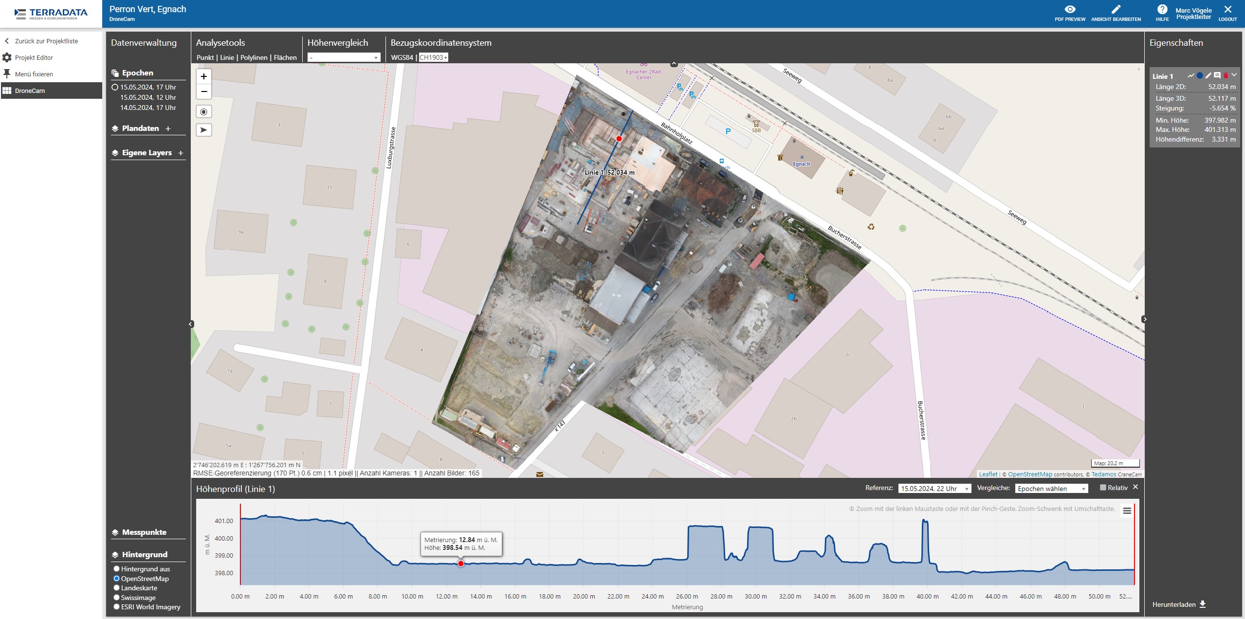
The data collected in the form of a high-resolution and georeferenced orthophoto with height information is uploaded to our TEDAMOS Web platform. Various useful functions can be utilised via this platform:
- Point, area and volume calculations for dimensions
- Plan data overlay for acceptances from the office
- Target/actual comparisons for quality assurance
- Flatness and slope checks
- Visualisation of progress
- Height comparisons
We are currently carrying out a pilot project to optimise processes and interfaces. In the future, we will actively commission the DJI Dock 2, which will be used for a wide variety of applications. Stay tuned!
More news

Complexity & trends on construction sites
Terradata shared its monitoring experience on today's construction sites at the "Hexagon LIVE DACH+" conference in Wiesbaden (Germany) on April 29/30, 2024.

GNSS Ropeways
Many Swiss mountain railways rely on TEDAMOS GNSS solutions for the continuous long-term monitoring of their infrastructure.

Zurich main station city tunnel
Manual and automatic deflection measurements at the ends of excavation pits, temporary bridges, adjacent buildings and SBB and VBZ railway tracks