Block glacier monitoring Simplon Pass
Deformation analysis from high-resolution drone data

In the Swiss Alps, more and more block glaciers and permafrost areas are thawing, leading to increased landslides, debris flows, and rockfalls that threaten infrastructure and settlements. Combined with increasingly frequent heavy precipitation, this is resulting in debris flows in locations and on a scale that were previously unexpected.
Periodic drone flights using the TEDAMOS DroneCam solution are ideal for monitoring the extent and flow velocities of thawing block glaciers and permafrost areas.
In June 2024, heavy rainfall on the southern side of the Simplon Pass led to a massive debris flow. Debris from the Hübschhorn block glacier broke loose and buried the pass road within the Engi gallery for several meters. Within a few weeks, a comprehensive monitoring system with two objectives was developed: a warning system for long-term monitoring of the Hübschhorn block glacier and an alarm system for immediate response to short-term hazards such as rockfalls or debris flows.
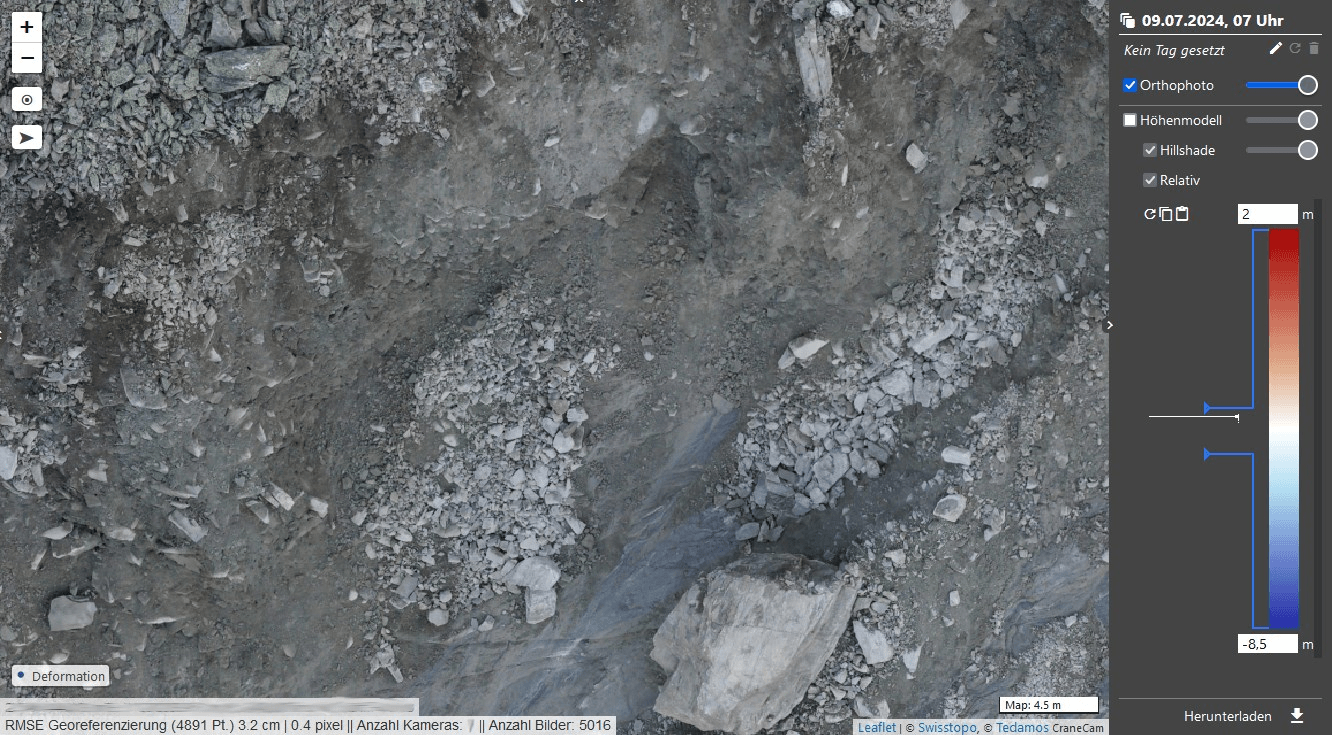
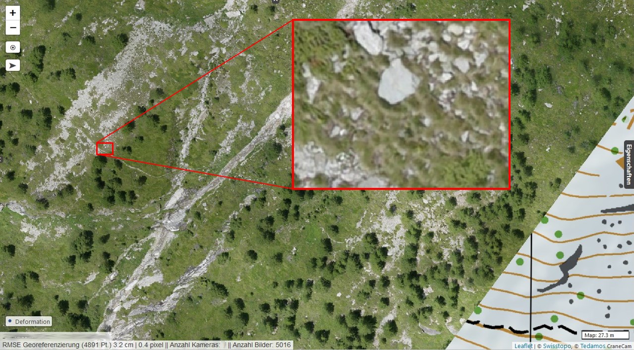
As part of the long-term warning system, a total of five high-resolution drone flights were carried out in 2024 over the entire slope (from 1,600 to 3,000 meters above sea level). Using the resulting orthophotos and high-resolution terrain models, the geologists commissioned by geoformer were able to analyze the movements of the block glacier and debris flow channel in detail.
Multiple flights with our area drone allow us to cover perimeters of several square kilometers and altitude differences of well over 1,000 m in a single day under good flight conditions. The high-resolution aerial images with a ground pixel size of 2 cm allow us to generate detailed orthophotos and very accurate surface models, which can be used to determine volume changes after debris flows, for example.
Using cleverly programmed comparative analyses of the high-resolution terrain models at different points in time, hundreds of measurement points with movement and speed vectors can be derived. The results are available to natural hazard specialists in TEDAMOS Web for interactive deformation analysis to display terrain shifts, material deposits and removals, or volume changes color-coded and/or with measured values.
Services
-
- Flight planning for challenging drone flights in high mountains
- Conducting periodic drone flights in challenging, high alpine terrain and difficult weather conditions (wind, etc.)
- Evaluation of a high-resolution orthophoto (GSD 2 cm) and elevation model
- 3D representation of selected perimeters
- Deformation analysis based on 3D deformation and velocity vectors
All recorded data is documented in TEDAMOS Web, our password-protected customer portal with 24/7 access.
Technologies
- Flight with WingtraOne GEN II
- TEDAMOS DroneCam


More reference projects
Block glacier monitoring Simplon Pass
Hübschhorn/Simplonpass
Deformation analysis from high-resolution drone data

Track and excavation monitoring Murtenstrasse Bern
Geomonitoring with geodetic and geotechnical sensors, supplemented with manual deformation measurements

Landslide Area Brienz/Brinzauls
Monitoring of an active landslide area with automatic and manual measurements

Renovation of the Palace Hotel, Luzern
Automatic height monitoring with hose levelling and tachymeter