Rockslide Kleines Nesthorn, Blatten (VS)
Natural Hazard Monitoring with Drones and Geotechnical Sensors

Starting on 14 May 2025, instabilities were observed on the flank of the Kleines Nesthorn above Blatten in the Lötschental valley (Switzerland). Falling rock blocks hit the Birch Glacier, triggering a debris flow that came to rest about 500 meters above the valley floor. Due to increasing rockfall activity, 92 people were evacuated on 17 May. On 19 May, all 300 residents of Blatten and the nearby hamlet of Ried were ordered to leave their homes within two hours.In the following days, the rockfalls intensified and the debris cone on the glacier grew to a height of around 80 meters. The additional pressure increased meltwater production, which formed a lubricating layer between the ice and the underlying ground, accelerating the glacier’s movement downhill.
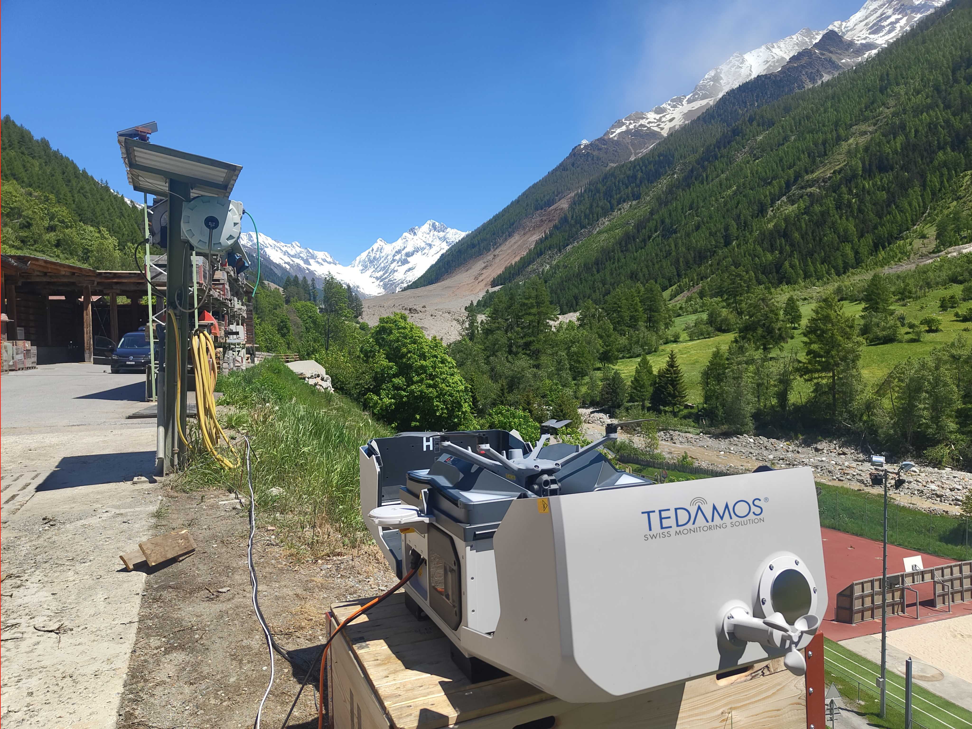
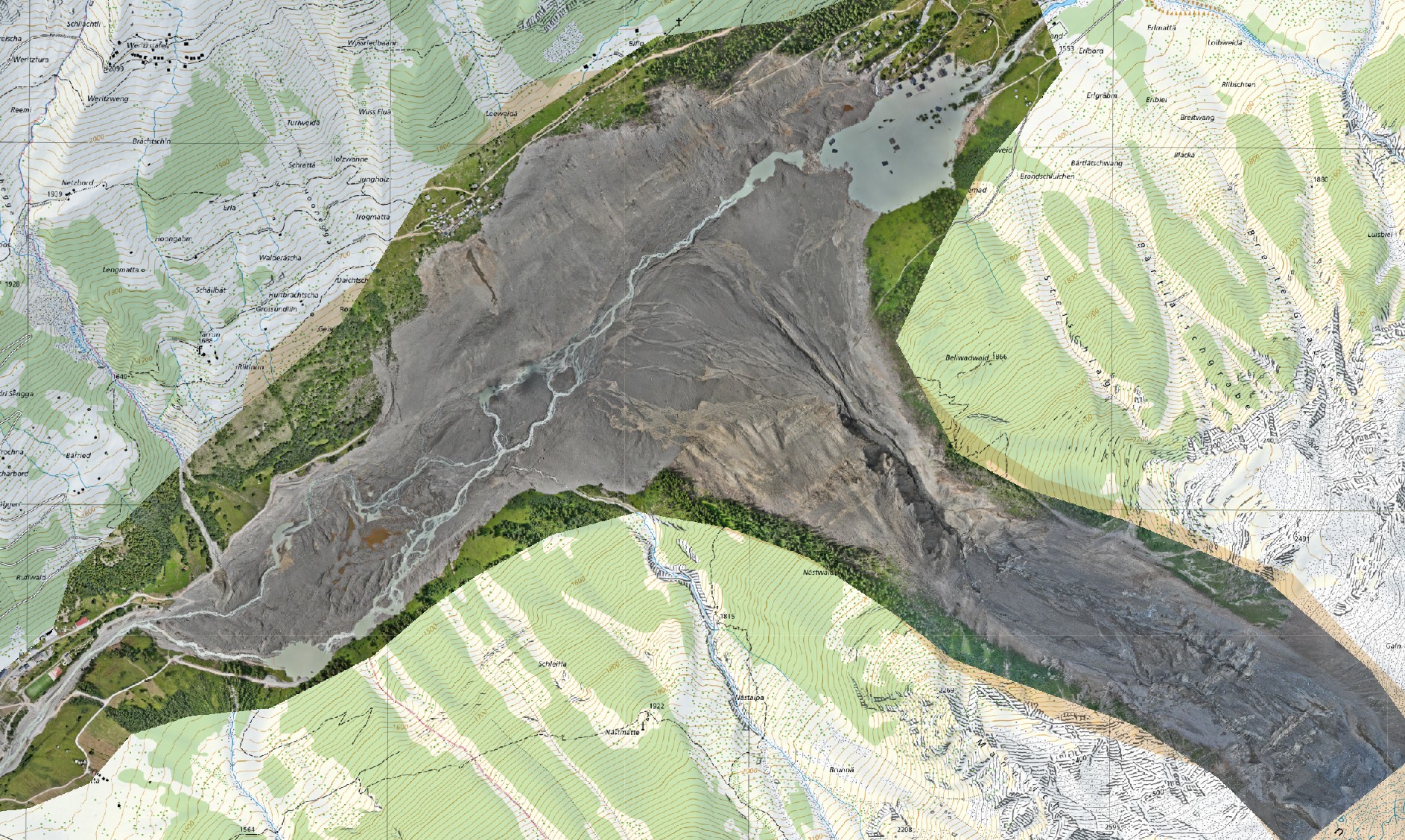
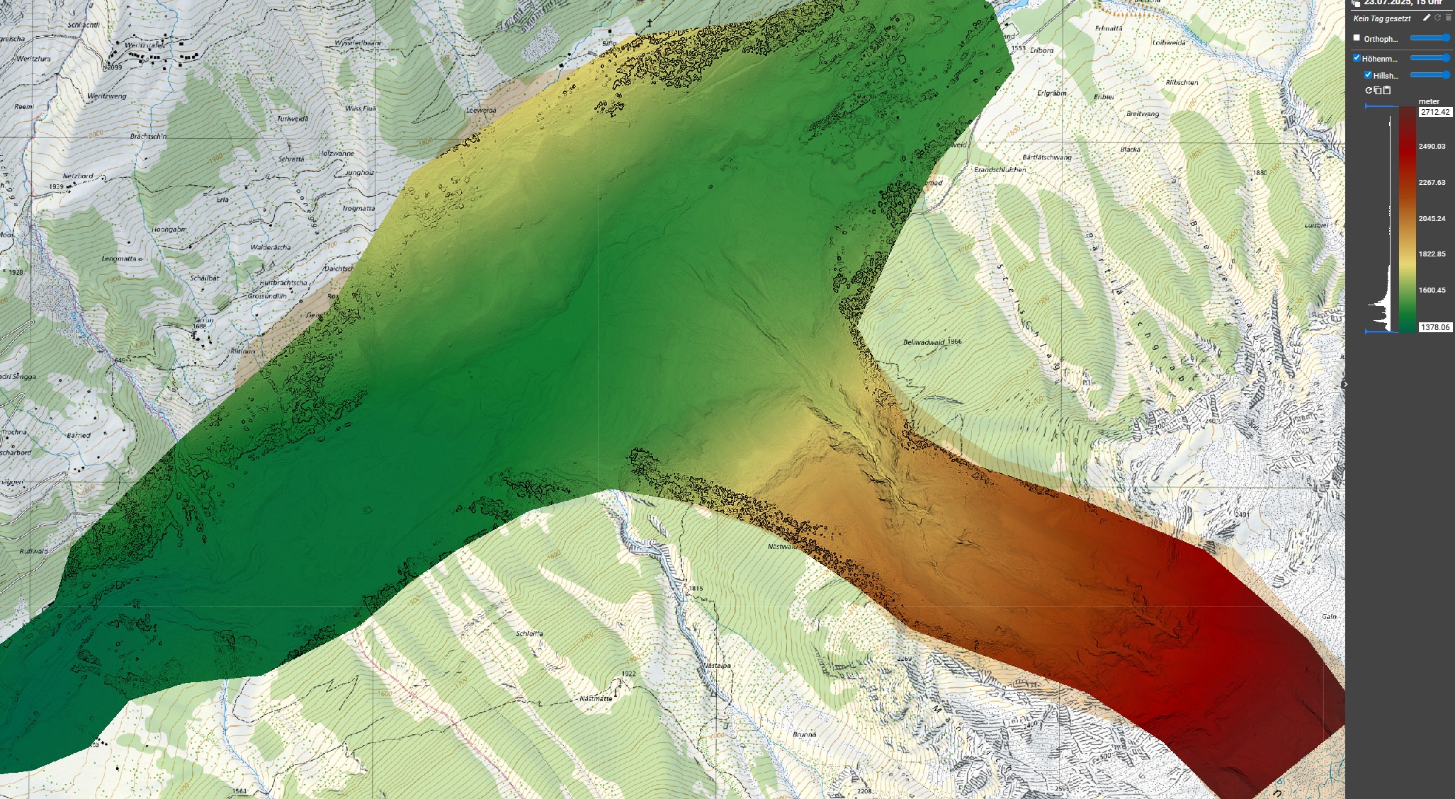
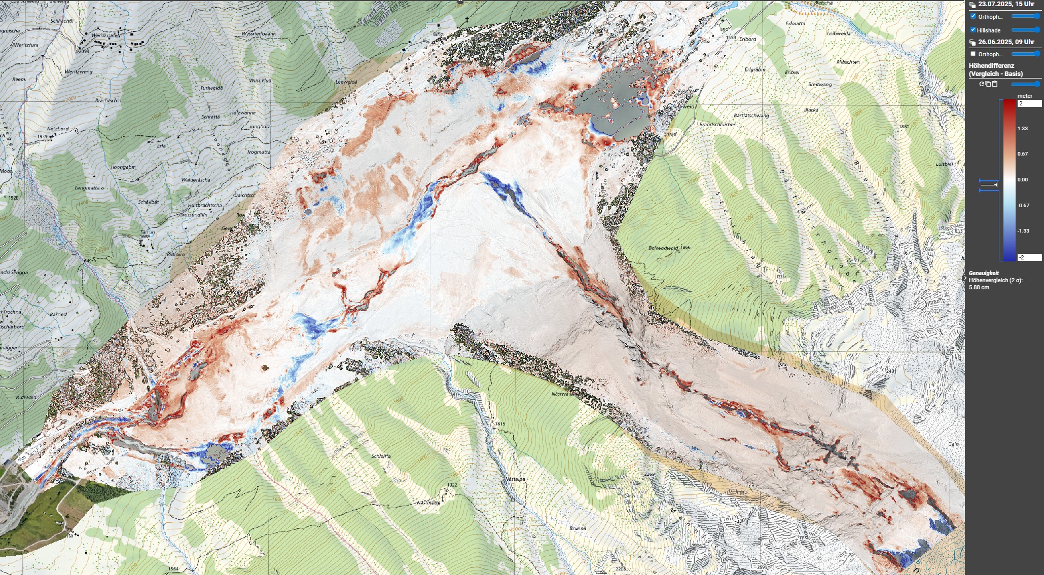
Terradata was commissioned to produce a high-resolution digital terrain model and orthophoto of the collapse area and the glacier to support the risk assessment by the responsible natural hazard experts. Photogrammetry and LiDAR data captured from a helicopter (by Sixense Helimap) were processed and visualized in the TEDAMOS Web platform.
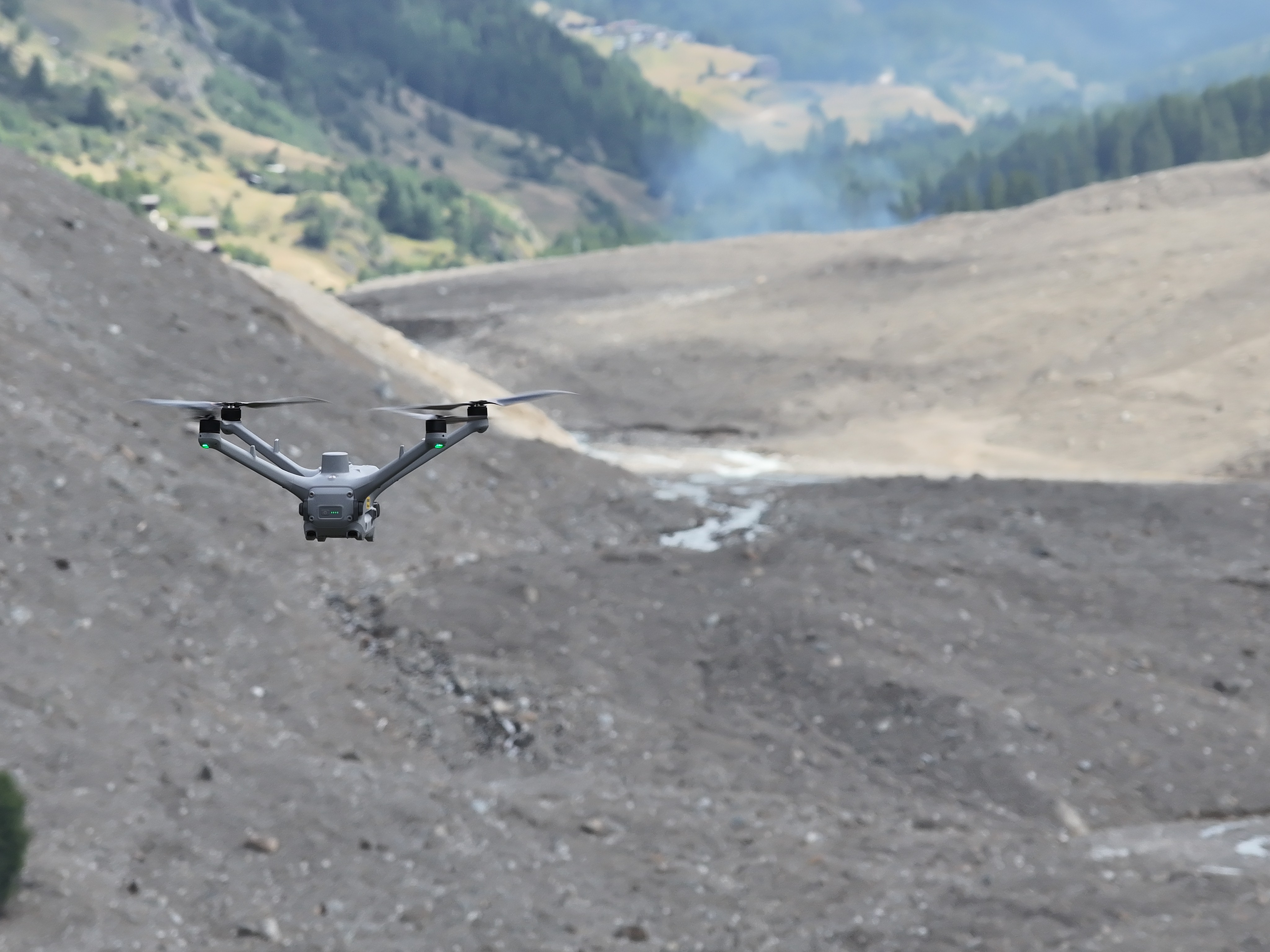
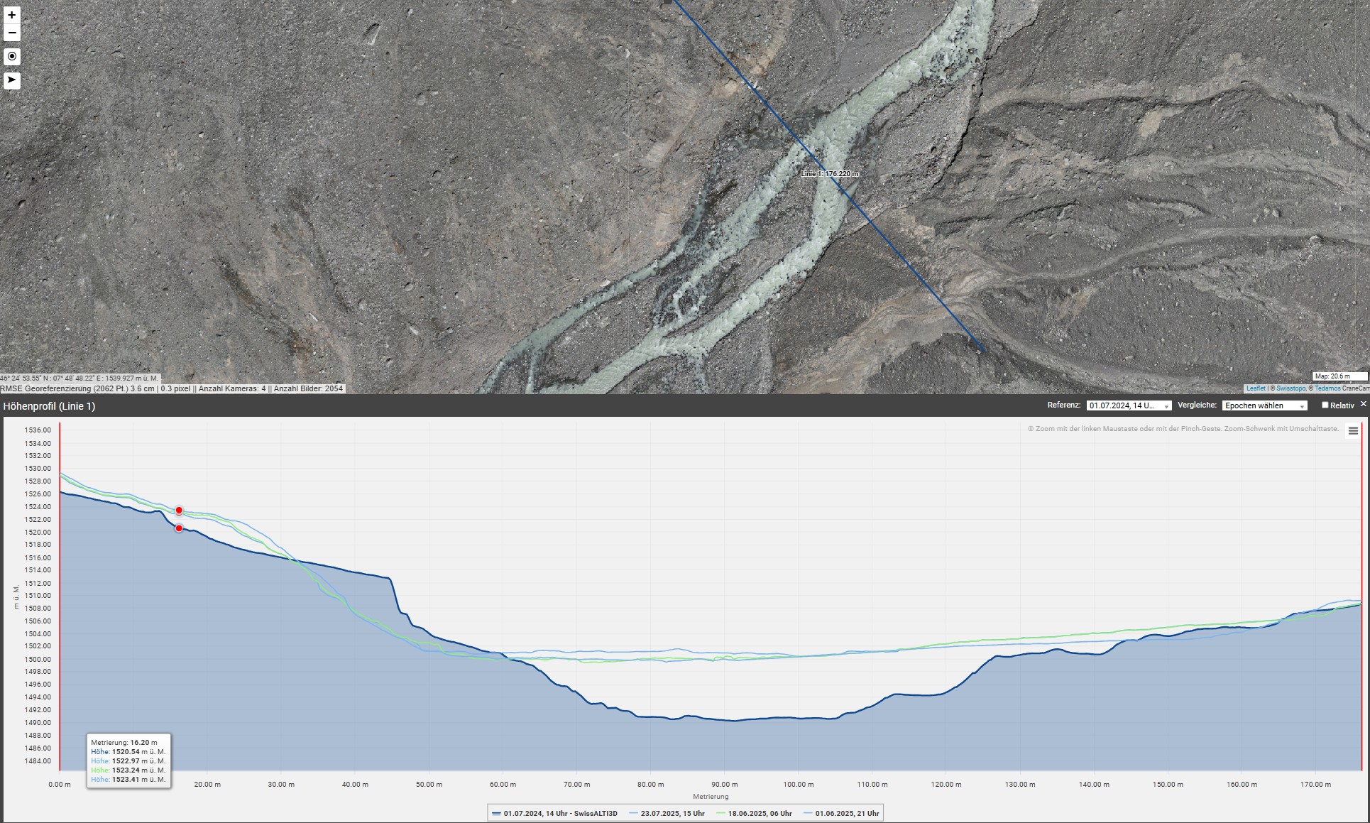
On 28 May, the Birch Glacier began sliding under the pressure of the rockslide debris and suddenly collapsed into the Birchbach gorge. The massive mixture of debris and ice buried around 90% of the village.The following day, a second aerial survey of the area was carried out from a helicopter. Starting 30 May, our partner company Remote Vision launched daily automated drone flights over the entire debris cone. The complete processing workflow was automated in TEDAMOS: after downloading the flight data, digital terrain models and orthophotos were generated automatically. Within just a few hours after each flight, the results were available on TEDAMOS Web. These datasets were used to analyze settlement processes within the debris and ice mass, as well as the behavior of the Lonza River, which gradually carved its way across the debris cone. The drone monitoring campaign continued until the end of November 2025.
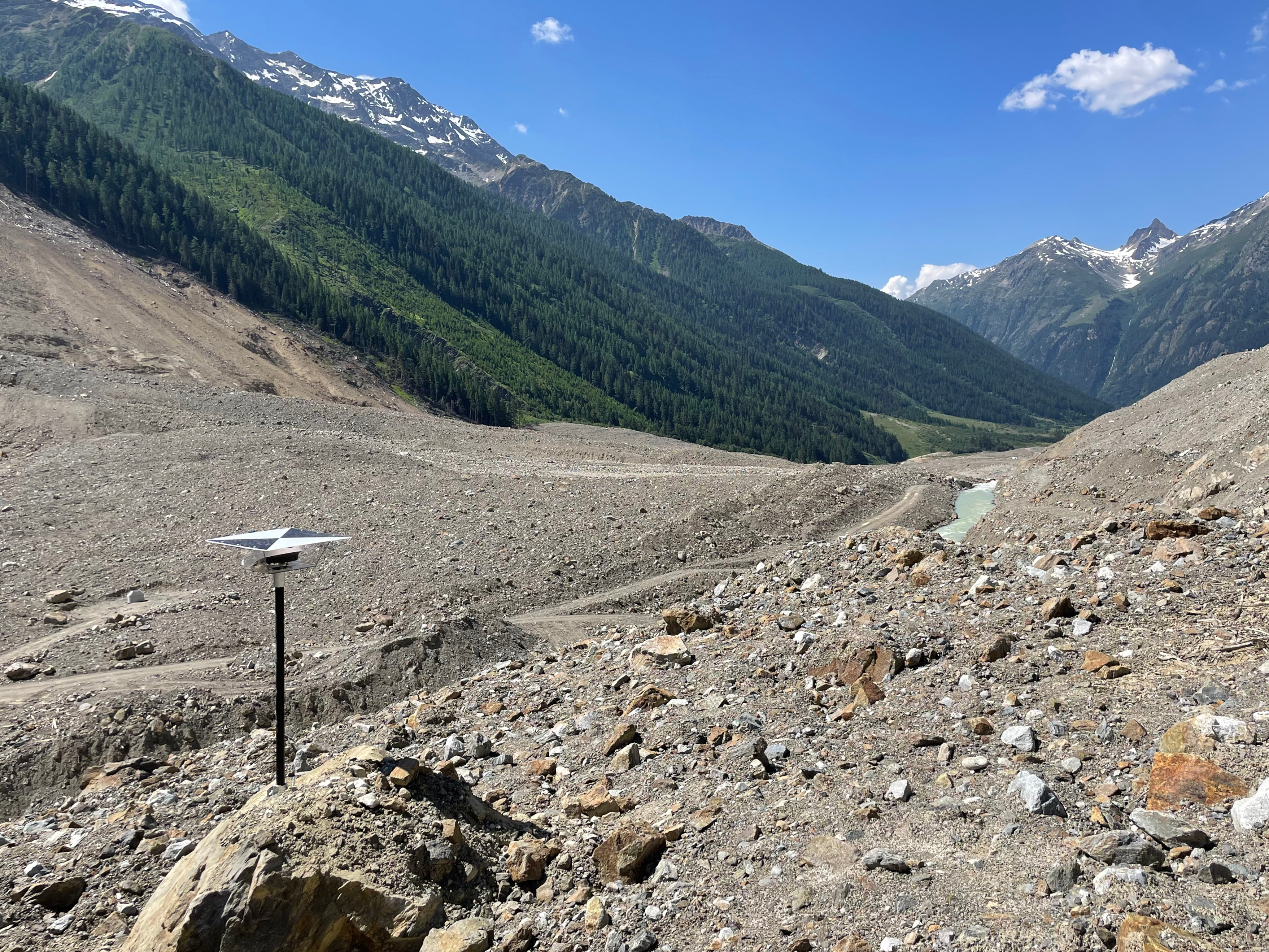
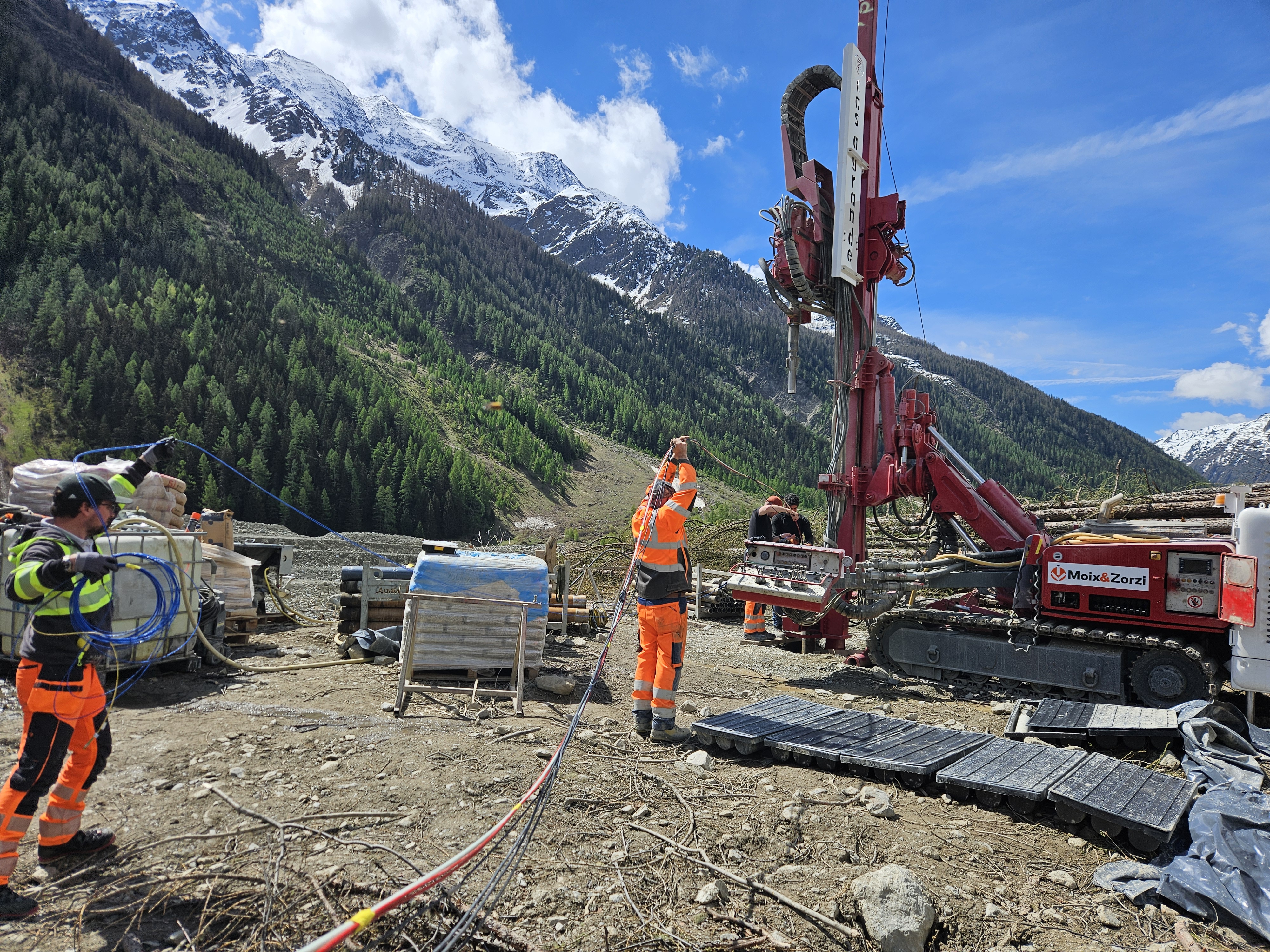
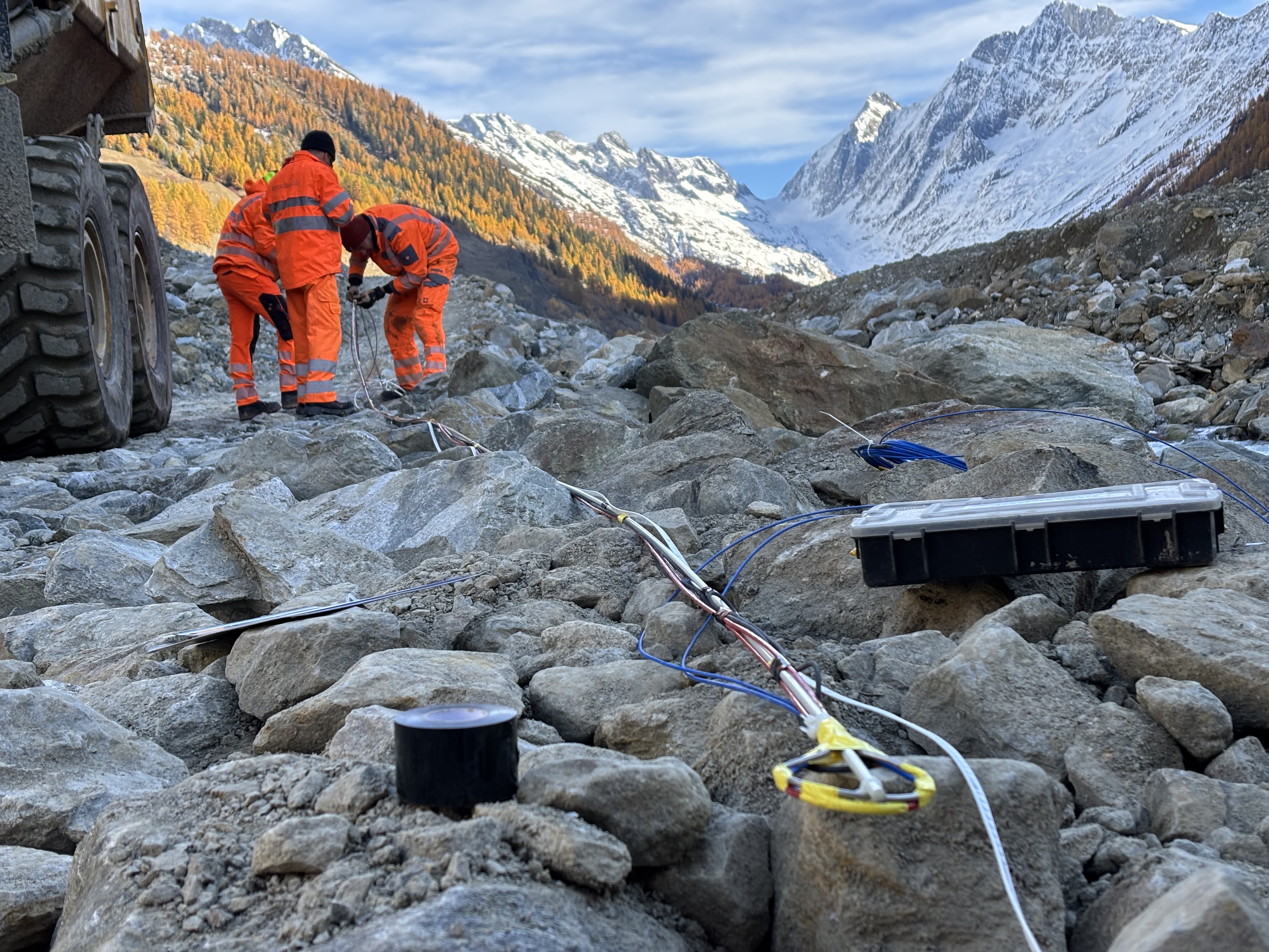
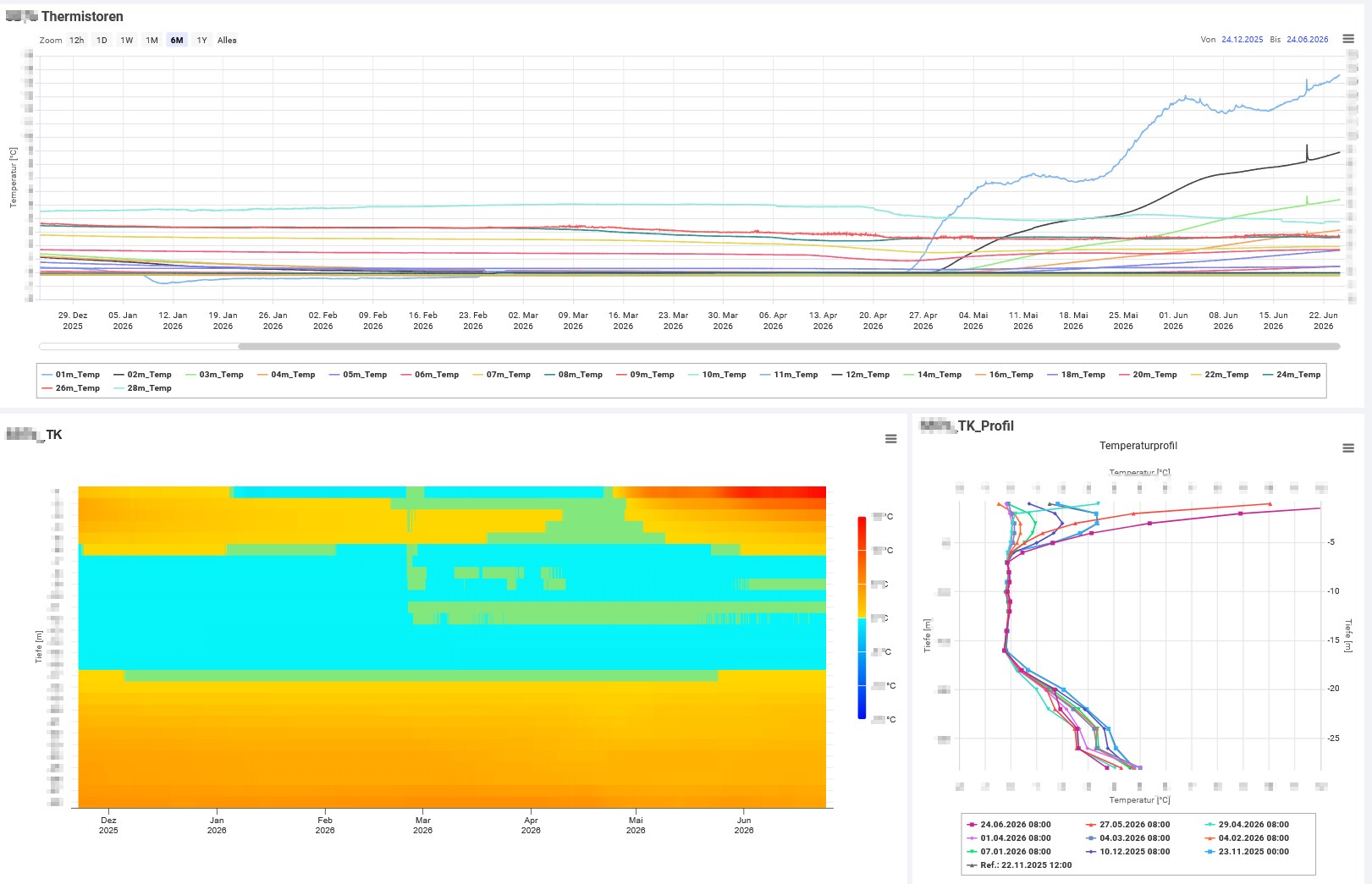
In December 2025 and June 2026, Terradata installed geotechnical monitoring systems within the debris cone. At 7 locations, each with two boreholes, pore water pressure sensors at different depths and thermistor chains reaching down to 28 meters were installed. These measurements now allow geologists to monitor the melting processes of the buried ice body within the debris cone.
Services
- Helicopter-based photogrammetry and LiDAR surveys
- Automated daily drone flights over the debris cone
- Ultra-high-resolution 3D terrain models and orthophotos
- Automated pore water pressure and thermistor measurements within the debris cone
- Visualization of all measurement results in the TEDAMOS web portal
Technologies
- TEDAMOS DroneCam with DJ Dock-solution
- 2 TEDAMOS GNSS Basic photogrammetric ground control point (GCP) targets
- 7 thermistor chains
- 28 pore water pressure sensors

More reference projects
Rockslide Kleines Nesthorn, Blatten (VS)
Blatten in Lötschental, Switzerland
Natural Hazard Monitoring with Drones and Geotechnical Sensors


Moosfluh Cable Car, Riederalp
Monitoring a large-scale terrain shift with TEDAMOS GNSS

Extension car park UG25, St. Gallen
Automatic and manual building monitoring with geodetic, geotechnical and environmental sensors

Haus zum Falken, Zürich-Stadelhofen
Automatic and manual excavation and track monitoring